
CitiesBeautiful.org is dedicated to the greater appreciation and deeper understanding of civic beauty worldwide. Numerous statistical studies have shown the importance of aesthetics in the social and economic wellbeing of communities; for example, see Beautiful Places: The Role of Perceived Aesthetic Beauty in Community Satisfaction (http://www.creativeclass.com/rfcgdb/articles/Beautiful%20places.pdf).
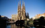
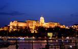
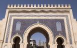
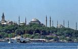
The CitiesBeautiful.org website categorizes and maps more than 1,000 beautiful sites and events at the 20 CITIES tab. Looking to the future, the DRAWING BOARD tab describes recent and proposed development activities that potentially will contribute to the overall beauty of the 20 cities.
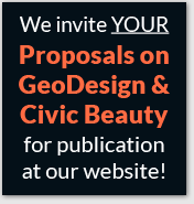
Still looking ahead, CitiesBeautiful.org actively promotes the beautification of cities using the GeoDesign methodology (see http://en.wikipedia.org/wiki/Geodesign). CitiesBeautiful.org is now soliciting high-quality, compelling GeoDesign projects to feature at the DRAWING BOARD tab. Do you have a GeoDesign project worthy of being published at the DRAWING BOARD tab?
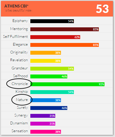
As an example of a commendable GeoDesign project, consider the CitiesBeautiful Index (CBI) scores at the Athens webpage – reproduced on the right. Athens scores highly on the Beautiful Facet of Chronicle (many historic features) but not so high on Nature (parks, river walks, etc.). Arguably, a GeoDesign project should focus on one of Athens’ low scoring Beautiful Facets to help overcome a current civic deficiency. Accordingly, in Athens an appropriate city planning project would determine the optimal location and design for one or more new urban parks. The GeoDesign project would encompass:
Resources for developing such a project could include Geographic Information System (GIS) software tools from ESRI (http://www.esri.com/) – especially Park and Recreation Finder, GeoPlanner, and ArcSketch. For case studies, see the Trust for Public Lands brochure entitled Geodesigning Parks for People (http://proceedings.esri.com/library/userconf/proc14/papers/892_149.pdf).
Ideally, local government officials will take serious notice of the published GeoDesign projects and take steps toward their implementation – with the potential for significantly improving the economy and quality of life of their city!
REQUIREMENTS: Submittals must pertain to one of the 20 cities covered by this website. The format should be similar to the projects at the DRAWING BOARD tab, i.e., a summary description, a large image, and a link to another webpage containing further information, interactive maps, etc. CitiesBeautiful.org reserves sole decision authority on which submittals will or will not be published. For more information on submitting a GeoDesign project, contact CitiesBeautiful.org via the email form at ABOUT US (bottom of this page). We look forward to hearing from you!